
File:Anchorage Alaska aerial view.jpg
本预览的尺寸:800 × 481像素。 其他分辨率:320 × 192像素 | 640 × 384像素 | 1,024 × 615像素 | 1,500 × 901像素。
原始文件 (1,500 × 901像素,文件大小:986 KB,MIME类型:image/jpeg)
| 描述 |
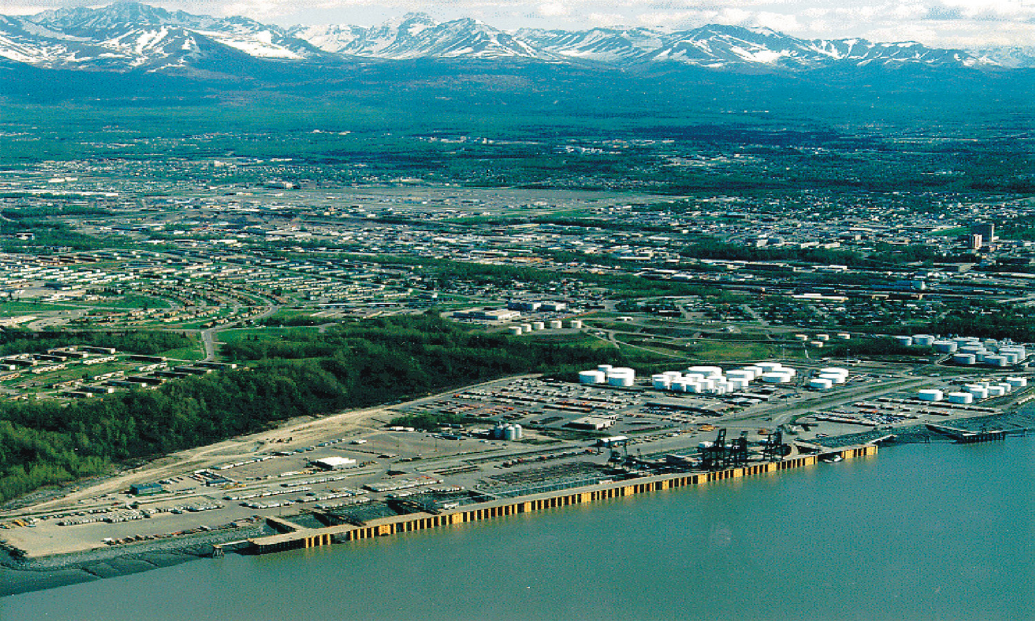
English: Aerial view of the Port of Anchorage, Alaska, USA. Project /Title: Cook Inlet Channel DredgingImage File: Cepoa-48.Jpg |
|||
| 图中地点 | Anchorage, Alaska, USA 61°14′24″N 149°53′20.4″W / 61.24°N 149.889°W |
|||
| 日期 | ||||
| 来源 |
U.S. Army Corps of Engineers Digital Visual Library Image page (Archive URL) Image description page (Archive URL) Digital Visual Library home page |
|||
| 作者 | U.S. Army Corps of Engineers, photographer not specified or unknown | |||
| 授权 (二次使用本文件) |
|
| 物体位置 | | 在以下服务上查看本图像和附近其他图像: OpenStreetMap |
|---|
文件历史
点击某个日期/时间查看对应时刻的文件。
| 日期/时间 | 缩略图 | 大小 | 用户 | 备注 | |
|---|---|---|---|---|---|
| 当前 | 2007年3月20日 (二) 04:43 | | 1,500 × 901(986 KB) | DanMS | {{Information | Description = Aerial view of the Port of Anchorage, Alaska, USA. | Source = U.S. Army Corps of Engineers Digital Visual Library<br />[http://images.usace.army.mil/images/Hires/Cepoa-48.Jpg Image page]<br />[http://images.usace.a |
文件用途
以下2个页面使用本文件:
全域文件用途
以下其他wiki使用此文件:
- be.wikipedia.org上的用途
- bg.wikipedia.org上的用途
- cv.wikipedia.org上的用途
- de.wikivoyage.org上的用途
- el.wikipedia.org上的用途
- en.wikipedia.org上的用途
- en.wikivoyage.org上的用途
- es.wikipedia.org上的用途
- fr.wikipedia.org上的用途
- fr.wikivoyage.org上的用途
- fy.wikipedia.org上的用途
- gl.wikipedia.org上的用途
- hu.wikipedia.org上的用途
- it.wikipedia.org上的用途
- it.wikivoyage.org上的用途
- ml.wikipedia.org上的用途
- ms.wikipedia.org上的用途
- nl.wikipedia.org上的用途
- no.wikipedia.org上的用途
- pt.wikipedia.org上的用途
- ru.wikipedia.org上的用途
- ru.wikivoyage.org上的用途
- sd.wikipedia.org上的用途
- sr.wikipedia.org上的用途
- th.wikipedia.org上的用途
- tr.wikipedia.org上的用途
- vep.wikipedia.org上的用途
- vi.wikipedia.org上的用途
- www.wikidata.org上的用途