
File:Ireland trad counties named.svg

此SVG文件的PNG预览的大小:375 × 469像素。 其他分辨率:192 × 240像素 | 384 × 480像素 | 614 × 768像素 | 819 × 1,024像素 | 1,637 × 2,048像素。
原始文件 (SVG文件,尺寸为375 × 469像素,文件大小:1.03 MB)
| 描述 |
Čeština: Mapa irských hrabství se jmény, hrabství Severního Irska jsou vybarveny okrově
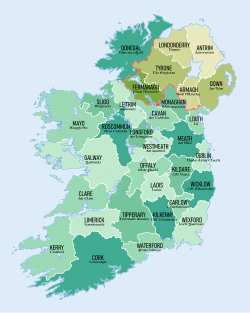
English: Map of Ireland's counties with names, Northern Ireland counties colored tan |
| 日期 | (UTC) |
| 来源 | |
| 作者 |
|
| 其他版本 |
此文件衍生的作品:
|


本文件采用知识共享署名-相同方式共享 3.0 未本地化版本许可协议授权。
- 您可以自由地:
- 共享 – 复制、发行并传播本作品
- 修改 – 改编作品
- 惟须遵守下列条件:
- 署名 – 您必须对作品进行署名,提供授权条款的链接,并说明是否对原始内容进行了更改。您可以用任何合理的方式来署名,但不得以任何方式表明许可人认可您或您的使用。
- 相同方式共享 – 如果您再混合、转换或者基于本作品进行创作,您必须以与原先许可协议相同或相兼容的许可协议分发您贡献的作品。
原始上传日志
This image is a derivative work of the following images:
- File:Population_density_of_Ireland_map2002.svg licensed with PD-self
- 2009-10-17T14:30:14Z The Illusional Ministry 800x1000 (635831 Bytes) Dublin now in black text
- 2009-10-17T14:27:13Z The Illusional Ministry 800x1000 (636262 Bytes) {{Information |Description=Map of Ireland's population density (people per km2). Based upon Republic of Ireland - 2002 Census results. |Source=*[[:File:Ireland_complete.svg|]] |Date=2009-10-17 14:25 (UTC) |Author=*[[:File:Ire
Uploaded with derivativeFX
文件历史
点击某个日期/时间查看对应时刻的文件。
| 日期/时间 | 缩略图 | 大小 | 用户 | 备注 | |
|---|---|---|---|---|---|
| 当前 | 2019年1月6日 (日) 09:50 | | 375 × 469(1.03 MB) | XrysD | Fixed typo: Offlay-->Offaly |
| 2018年7月7日 (六) 17:55 |  | 375 × 469(1.03 MB) | XrysD | Corrected Irish name for Carlow to Ceatharlach. Fixed scaling to 100dpi to match original sizing. | |
| 2018年7月5日 (四) 18:41 |  | 375 × 469(1.03 MB) | XrysD | Updated version. Created using GIS data from Ordnance Survey of Ireland (OSI Opendata https://data-osi.opendata.arcgis.com/) and Ordnance Survey of Northern Ireland (OSNI Opendata https://www.nidirect.gov.uk/services/osni-open-data-portal) to re-create the actual traditional county borders, not just the existing Irish Republic county borders in the previous map. Added ColorBrewer derived shading to differentiate counties visually. Added Irish language names for counties. | |
| 2009年11月23日 (一) 07:30 |  | 400 × 500(484 KB) | Sswonk | {{Information |Description=Map of Ireland's counties with names, Northern Ireland counties colored tan |Source=*File:Population_density_of_Ireland_map2002.svg |Date=2009-11-23 07:27 (UTC) |Author=*File:Population_density_of_Ireland_map2002.svg |
文件用途
没有页面链接到本图像。
全域文件用途
以下其他wiki使用此文件:
- ban.wikipedia.org上的用途
- County Dublin
- Mal:County ring Irlandia
- Dún Laoghaire–Rathdown
- Fingal
- Dublin Kelod
- County Carlow
- County Kildare
- County Kilkenny
- County Laois
- County Longford
- County Louth
- County Meath
- County Offaly
- County Westmeath
- County Wexford
- County Wicklow
- County Galway
- County Leitrim
- County Mayo
- County Roscommon
- County Sligo
- County Clare
- County Cork
- County Kerry
- County Limerick
- County Tipperary
- County Waterford
- ca.wikipedia.org上的用途
- cs.wikipedia.org上的用途
查看此文件的更多全域用途。