
File:Victoria locator-MJC.png
此為最大尺寸。
Victoria_locator-MJC.png (563 × 476 像素,檔案大小:12 KB,MIME 類型:image/png)

|
本圖片是以PNG、GIF或JPEG格式上傳。然而,其中包含的資料或訊息,應該重新建立成可縮放向量圖形(SVG)檔案,以更有效率或更準確的方式儲存。如有可能,請上傳本圖片的SVG格式版本。在上傳之後,請修改維基各姊妹計畫中所有使用舊版圖片的條目(列在圖像連結章節中),替換為新版圖片,並在舊圖片的描述頁中加入{{Vector version available|新圖片名稱.svg}}模板,同時移除本模板。
|
摘要
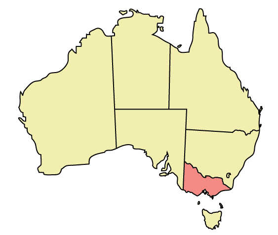
Map of Australia highlighting Victoria
Made in Adobe Illustrator by Martynam and released under the GFDL
授權條款
| 此檔案採用共享創意 姓名標示-相同方式分享 3.0 未在地化版本授權條款。 受免責聲明的約束。 | ||
| ||
| 已新增授權條款標題至此檔案,作為GFDL授權更新的一部份。 |

|
已授權您依據自由軟體基金會發行的無固定段落、封面文字和封底文字GNU自由文件授權條款1.2版或任意後續版本,對本檔進行複製、傳播和/或修改。該協議的副本列在GNU自由文件授權條款中。 受免責聲明的約束。 |
檔案歷史
點選某个日期/時間檢視對應時刻的檔案。
| 日期/時間 | 縮圖 | 大小 | 用戶 | 備註 | |
|---|---|---|---|---|---|
| 目前 | 2005年12月30日 (五) 22:49 | | 563 × 476(12 KB) | Snowdog | Map of Australia highlighting Victoria Made in Adobe Illustrator by Martynam and released under the GFDL Category:Maps of Australia |
檔案用途
下列30個頁面有用到此檔案:
- User:Arthur19q3
- User:Atitarev
- User:Bobby Lee
- User:Champion/用户框
- User:Chiashinliu
- User:Davidzhang23
- User:Fiveapu
- User:Hnjhj
- User:JK6126GPHEVN5Q2
- User:King9001
- User:Livelikerw
- User:Lucy melbourne/沙盒/JP3
- User:Lyra~zhwiki
- User:MephistophelesZIOL
- User:Prinz.W
- User:Sanaru15010029
- User:Shack
- User:TJS
- User:Wyvernridercross
- User:Yejianfei
- User:Yejianfei/Userboxes
- User:ZhangZihao
- User:大葱大骢
- User:好名都不见了
- User:李沛钊
- User:虫子
- User talk:Lucy melbourne
- Wikipedia:用户框/地域/澳洲
- Template:User Melbourne
- Template:User Melbourne2
全域檔案使用狀況
以下其他wiki使用了這個檔案:
- af.wikipedia.org 的使用狀況
- ar.wikipedia.org 的使用狀況
- be.wikipedia.org 的使用狀況
- ckb.wikipedia.org 的使用狀況
- cs.wikipedia.org 的使用狀況
- cy.wikipedia.org 的使用狀況
- de.wikipedia.org 的使用狀況
- dtp.wikipedia.org 的使用狀況
- en.wikipedia.org 的使用狀況
- Hobsons Bay
- Galvin railway station
- Chum Creek
- Don Valley, Victoria
- Gruyere, Victoria
- Kalorama, Victoria
- Launching Place
- Macclesfield, Victoria
- Menzies Creek
- Seville, Victoria
- Seville East
- Sherbrooke, Victoria
- Tremont, Victoria
- Yellingbo
- Cranbourne South
- Narre Warren East
- Warneet
- Dandenong North
- Dandenong South
- Noble Park North, Victoria
- Blairgowrie, Victoria
- Boneo
- Main Ridge, Victoria
- Merricks North
- Red Hill, Victoria
- Red Hill South
- Capel Sound
- Simpson Barracks
- Yallambie
- Attwood, Victoria
- Oaklands Junction
- Somerton, Victoria
- Burnside, Victoria
- Hillside, Victoria
- Kurunjang
- Ardeer, Victoria
- Calder Park, Victoria
- Delahey
- Warranwood
- Kooyong, Victoria
- Brooklyn, Victoria
- Cremorne railway station
檢視此檔案的更多全域使用狀況。